Data on the biodiversity of more than 10 million hectares of land in central Australia are now openly available via TERN. Collected by Indigenous rangers and traditional owners in collaboration with the mining industry, land council and environmental consultancy partners, the dataset is an invaluable resource for the conservation and sustainable use of one of Australia’s most remote and under-surveyed regions.
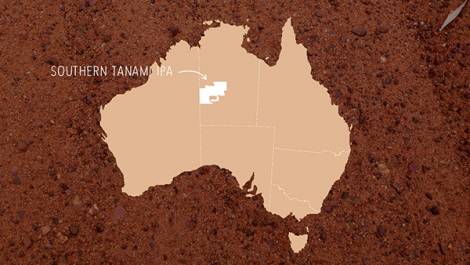
In the Northern Territory’s Southern Tanami Indigenous Protected Area (IPA) Indigenous rangers are driven by a desire to pass on knowledge about country, create jobs for young people and to stop new ecological threats entering their unique and precious region.
“We’ve still got Yapa law and culture,” explains one traditional owner. “This law comes from land and is about looking after land; we want to keep this strong and learn new ways to look after country. Our IPA is a really big area of land and we want to work together with other people, partners, to look after it.”
The Tanami Regional Biodiversity Monitoring project is just one of the ways in which the traditional owners and the Warlpiri Rangers of the Southern Tanami IPA are achieving their goals.
The data collected from the Tanami Regional Biodiversity Monitoring project includes records of a number of threatened species including the Bilby, Macrotis lagotis, Great Desert Skink, Liopholis kintorei, Mulgara, Dasycercus blythi and the Spectacled Hare-wallaby, Lagorchestes conspicillatus.
Under the project, a collaboration between Newmont Mining Corporation, the Central Land Council and Low Ecological Services since 2005, over 30 Indigenous rangers and many traditional owners collect data from 89 sites using both Indigenous knowledge and skills and scientific survey techniques. A combination of animal tracking, bird surveys, small vertebrate trapping and vegetation transects are used following training from project partners.
Covering more than 10 million hectares, 1.3 times the area of Tasmania, the dataset fills a huge information gap and represents an invaluable resource for the conservation and sustainable use of one of Australia’s most remote and under-surveyed regions.
Data from the Tanami Regional Biodiversity Monitoring project are now openly available via TERN’s AEKOS data portal
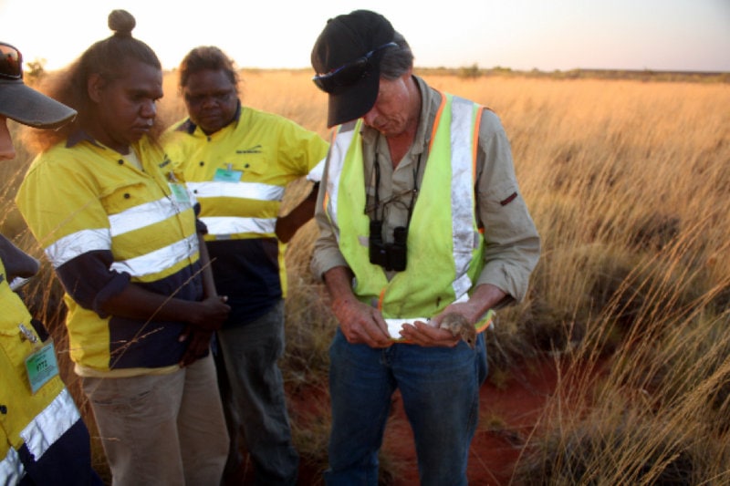
Warlpiri Women Rangers, Christine Ellis Michaels and Madeline Dixon learning about elliott trapping Mulgara from Bill Low of Low Ecological Services (image courtesy of the Central Land Council)
Essential data services to Indigenous ranger program and land councils
All across Australia, Indigenous ranger groups like the one in the Tanami are involved in biodiversity monitoring programs, collecting vital ecosystem data on plants and animals and how they’re changing. A question often asked, however, is where does that information go?
According to Dr Peter Donohoe, of the Central Land Council, these data struggle to make it to the public and wider research community, primarily due to the lack of data management skills and available technical resources, rather than a lack of will.
“Traditional owners from the Tanami region are strong in stating that they want to share information on plants and animals so that the Australian people know there are things living in the Tanami Desert, that it is not empty,” says Peter.
“By releasing the Tanami Regional Biodiversity Monitoring data through TERN, the Central Land Council is hoping that it can support a broader understanding of flora and fauna in Central Australia and receive advice on research and management that comes from the use of the data.”
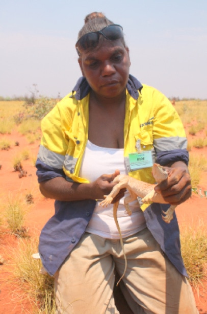
Warlpiri Ranger Christine Ellis Michaels holding a Sand Goanna caught while tracking as part of the Tanami Regional Biodiversity Monitoring Project (image courtesy of the Central Land Council)
Responsible data publishing
In accordance with TERN’s responsible data publishing policies, the Tanami Regional Biodiversity Monitoring dataset has been released without exact location information. This has been done to ensure the protection of sensitive cultural sites and threatened plants and animals from inappropriate visitation that could bring in other threats like weeds, feral animals, vandalism and poaching.
Central Land Council can be contacted to obtain access to a version of the dataset that contains accurate locational information.
Click here to access the Tanami Regional Biodiversity Monitoring dataset via TERN’s AEKOS data portal.
For more information on the Tanami Regional Biodiversity Monitoring project please contact Central Land Council’s Sam Rando
For more information on TERN’s data services, including publishing and licensing, click here.
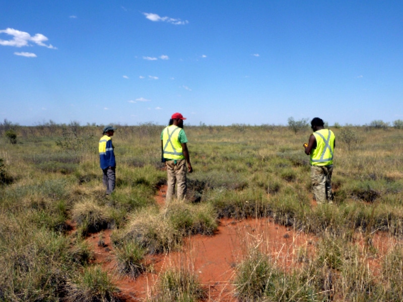
Southern Tanami IPA officers a Warlpiri Ranger collecting tracking and vegetation data using CyberTracker (image courtesy of the Central Land Council)
Northern Tanami Rangers (L to R) Dione Kelly, Jonathon Dixon and Braedon Hogan during bird surveys on the Tanami Regional Biodiversity Monitoring project (image courtesy of the Central Land Council)