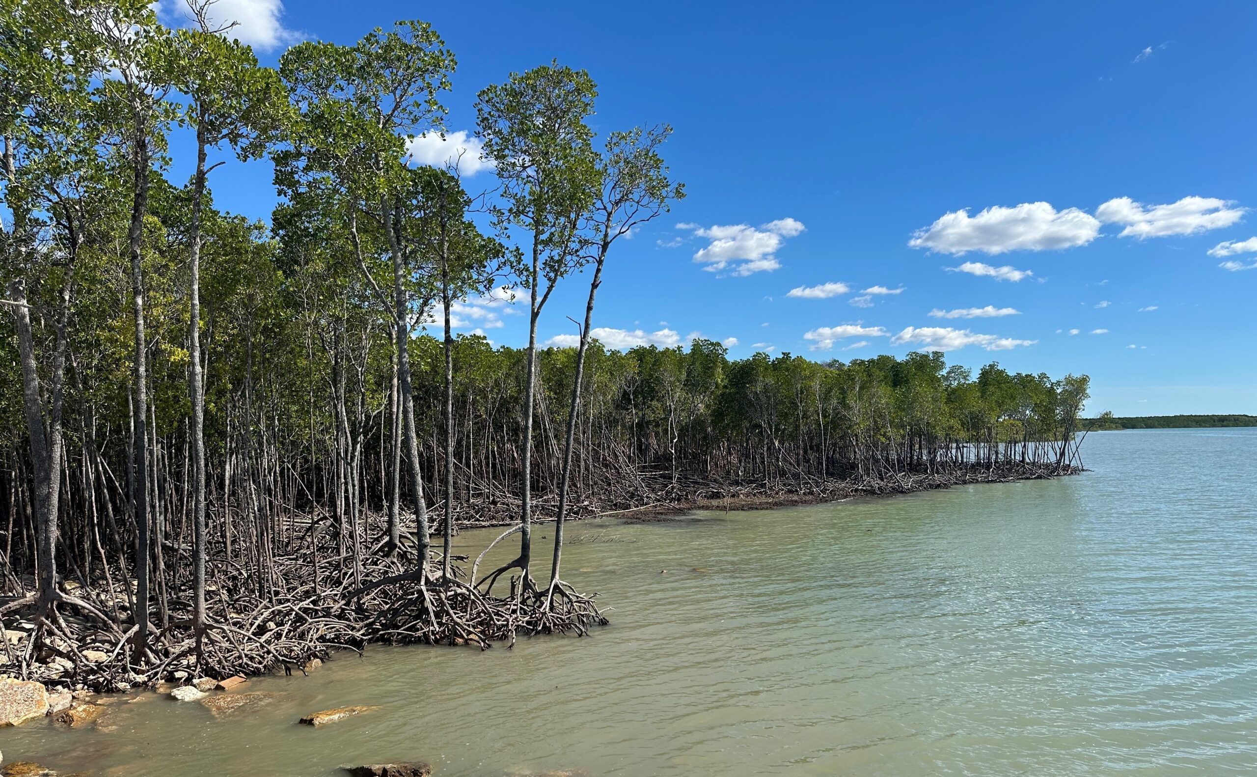
Can tidal wetlands keep up with sea-level rise around Australia? Mangroves, salt marsh and supratidal forests are important tidal wetland ecosystems contributing a range of ecosystem services. However, these coastal wetlands are highly sensitive to changes in sea-level, given their low coastal elevation and frequent tidal inundation.
Article by Madeline Goddard
Madeline Goddard is a coastal scientist and PhD candidate. She is currently co-coordinating the NCRIS-enabled TERN coastal research infrastructure project.
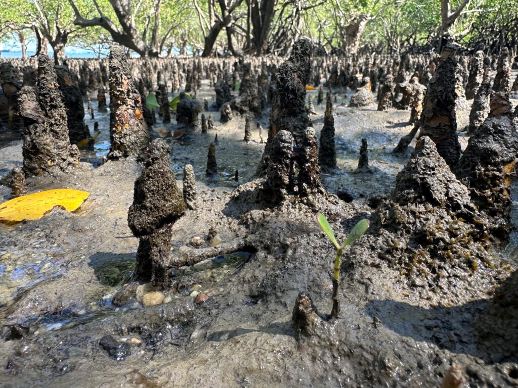
A tiny Sonneratia alba seedling amongst the pneumatophores of its forebears in a mangrove mature forest. This seaward mangrove community currently spends more than half the time underwater in Darwin Harbour, NT. Photo credit: Madeline Goddard
To better understand tidal wetland response and vulnerabilities to sea–level rise, Australian and international researchers have been monitoring vertical elevation change for many years using Surface Elevation Tables (SETs), a method developed by the USGS.
SETs precisely measure tidal wetland surface height over time and can track the changes in wetland elevation that occur through plant root growth belowground and sediment deposition aboveground.
Monitoring elevation of these important wetlands through time allows for comparisons to the rate of change with sea level rise and other environmental impacts in different tidal wetland regions.
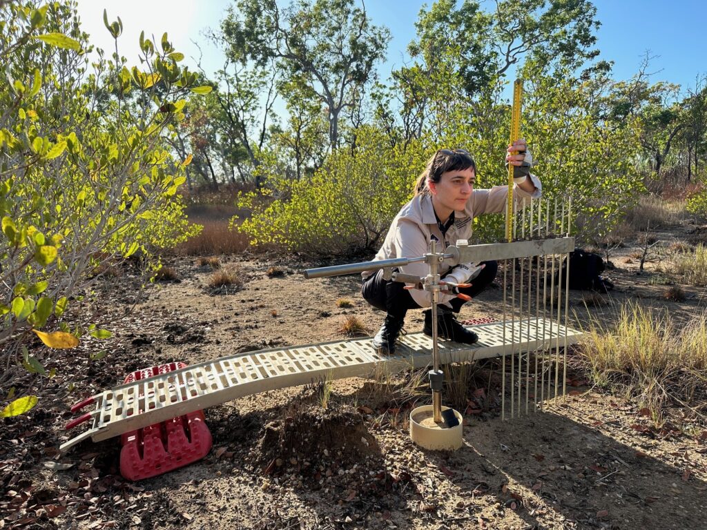
Measuring a SET in Darwin Harbour. This site was salt tolerant grasses a few years ago. Tidal inundation of the site now means the mangrove Lumnitzera racemosa grows right up to the terrestrial savanna. Photo credit: Madeline Goddard.
At over 30 sites around Australia, an ever-growing 300+ SETs have been established by researchers and coastal managers. These SETs complement many international sites also using the same SET method, answering questions around coastal wetland response to climate change, carbon fluxes and identifying vulnerabilities to change.
The NCRIS-enabled TERN project is supporting the emerging ‘OzSET’ national network, ensuring standardised site establishment, data collection and publication, and analysis to better monitor coastal wetland vulnerability to sea level rise. This new capability is led by ARC Laureate Fellow Professor Catherine Lovelock from the University of Queensland, with Madeline Goddard and Vicki Bennion coordinating the three-year TERN pilot project. Together with existing and future SET users, they will be developing a national network, to ensure better management decisions, a clearer picture of tidal wetland vulnerability and resilience, and better utilisation and communication of this rich, multi-year dataset.
