Critical Zone Observatories
The Australian CZO network (OzCZO)
Australian Government funding is enabling research into Australia’s critical zone—Earth’s outer skin, from treetop to bedrock, where water, atmosphere, ecosystems, soil and rock interact—to better understand and manage the availability of its life-sustaining resources.
$1.2M of Australian Government funding to a consortium of Australian universities has helped the creation of a network of Critical Zone Observatories (CZO) across Australia.
The funding—part of the Australian Research Council’s Large Infrastructure, Equipment and Facilities scheme (ARC LIEF)—has created a new network of five monitoring sites in five states, sampling a diversity of Australia’s geologies, biomes, land uses and climates.
State-of-the-art, automated monitoring infrastructure at the sites records stocks and flows of carbon, water, energy and mass across the Critical Zone—the vertical span from plant canopies to fresh bedrock.
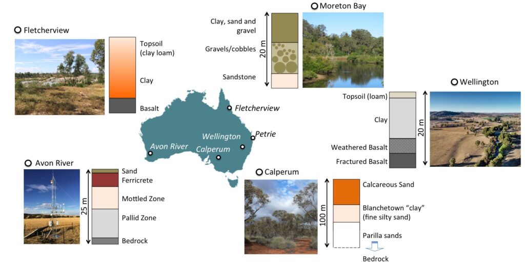
Collaboration and co-location
The Australian CZO network (OzCZO) is being collaboratively developed and managed by a team of researchers from the University of Western Australia, the University of Adelaide, the University of the Sunshine Coast, James Cook University, and the University of New South Wales. Generous co-contributions to the ARC LIEF funding from these six universities make the project possible.
The NCRIS-funded national research infrastructure projects of TERN and AuScope and parts of the former Groundwater project are also playing leading roles in building and operating the network’s monitoring infrastructure. TERN is not only associated with the CZO site infrastructure but will also make OzCZO data openly available via the TERN data portal.
The initiative adds critical monitoring capabilities missing from existing observation networks, like NCRIS-enabled TERN and the SmartSat CRC’s Earth Monitoring Capability, including soil dynamics, root zones and hydro- and biomantles; and integrated processes between the above- and below-ground components of the Critical Zone.
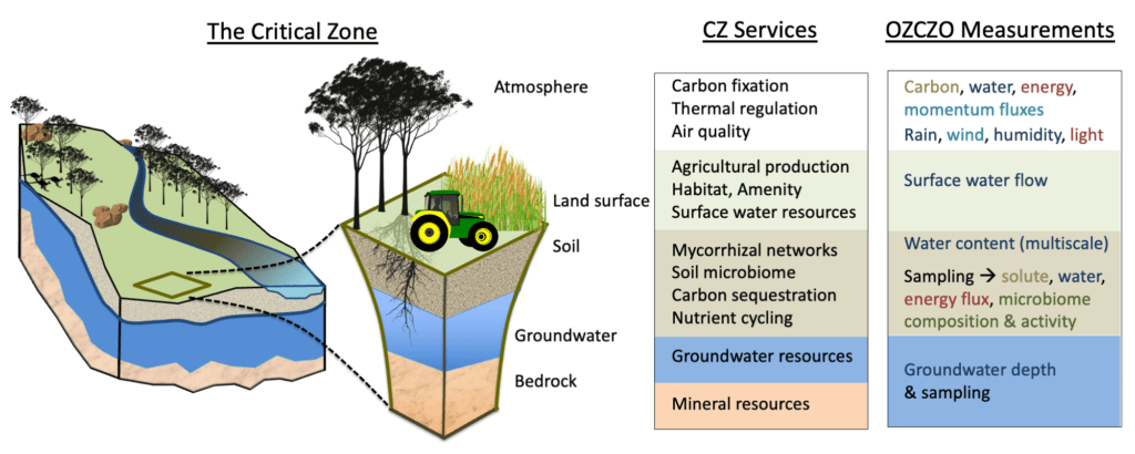
The critical zone stretches vertically from bedrock to the atmospheric boundary and comprises bedrock, weathered/saprolitic rock, aquifers, soil, the rhizosphere and microbiome in the regolith, habitats, canopies and the nearsurface atmosphere. The CZ provides numerous life-supporting services. OZCZO will enable the integration of understanding across CZ zones, by measuring dynamics relating to water (blue), energy (red), mass (brown), and biotic processes (green).
Filling essential knowledge gaps
The information collected will fill essential knowledge gaps about interactions of under- and above-ground environmental processes and their responses to disturbance and change.
For example, studies using the OzCZO are expected to provide new insights on ecosystem dependency to below-ground processes and demonstrate how changes to the land surface propagate underground. OzCZO will also generate new insights into urgent questions such as the fate and stability of carbon in deep soils, how sensitive groundwater recharge and streamflow are to changing vegetation and climate.
These interactions determine the sustainability of food, clean water, mineral resources and Australian ecosystems, and cannot be studied with existing environmental infrastructure.
Australian Government funding will also support the development of a robust, long-term strategy for more effective and collaborative Critical Zone science, helping catalyse Critical Zone science in Australia and joining a burgeoning international movement.
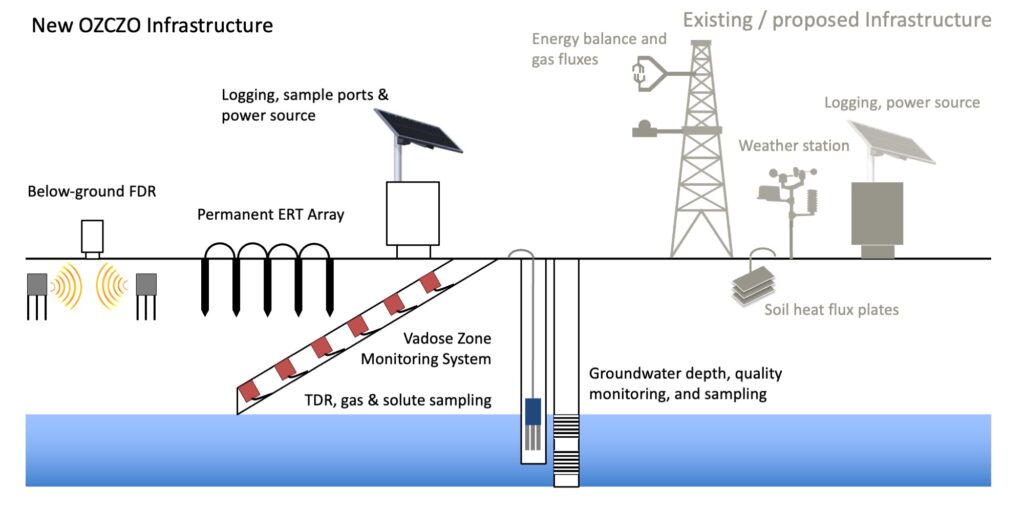
Illustration of OZCZO below-ground and terrestrial CZ observational instrumentation. The mix of pre-existing and new instrumentation shown here is applicable to the OZCZO core sites that are also TERN sites.
More information
- The OzCZO team is Associate Professor Sally Thompson; Professor David Chittleborough; Dr Juraj Farkas; Professor Jason Beringer; Dr Andrew Marshall; Dr Jamie Cleverly; Professor Wayne Meyer; Associate Professor Martin Andersen; Dr Matthias Leopold; and Dr Martin De Kauwe.
- The ARC LIEF CZO project has already attracted additional funds via an AuScope Opportunity Fund (AOF) for a two-year project called ‘Laying the foundations for the Australian Critical Zone Observatories’ in which Electric Resistivity Tomography (ERT) and Seismic Refraction (SR) will be deployed at the five core CZO sites across Australia. At each, the aim is to determine (i) Depth to bedrock, (ii) Water table depth, (iii) Sedimentologic layering, and (iv) Characteristics of the weathering profile.
- OzCZO is being built as community infrastructure. Researchers are encouraged to use the infrastructure and the data streams being collected to support cross-site, cross-domain science. The OzCZO team would love to discuss ideas with you and support research proposals with access to OzCZO infrastructure.
OzCZO News
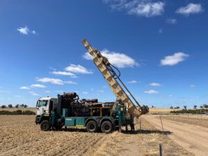
Real-time soil sensing and sampling for critical WA agricultural monitoring site
A state of the art Vadose-zone Monitoring System (VMS) has been successfully installed at the University of Western Australia (UWA) Ridgefield Farm, near Pingelley in
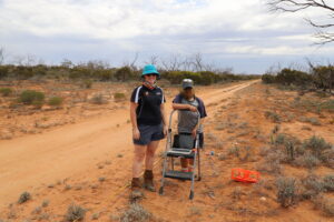
Critical Zone Observatory project kicks off at Calperum
The ARC-LIEF funded Critical Zone Observatory network (OZCZO) has started collecting data in South Australia.

Site of the month: Boyagin Wandoo Woodland SuperSite
This month we’re travelling to the wheatbelt region of Western Australia to visit TERN’s Boyagin Wandoo Woodland site and its paired Ridgefield Farm OzFlux site. Together, the sites’ automated monitoring infrastructure provide essential long-term continuous data to understand landscape dynamics in this biodiverse swath of Australia valued at almost AU$3 billion.

Paddock to reef: Australia’s newest monitoring SuperSite
The TERN-Queensland Government project to introduce continuous environmental monitoring sensors into the Burdekin region is progressing well.
The new monitoring equipment will allow TERN to deliver essential measures on the ecosystem functioning of grazing landscapes and enable improved pasture modelling for Queensland and beyond. Join us as we check in on the site’s progress.
Treetop to bedrock: understanding resilience of Australia’s Critical Zone to human impact
An interdisciplinary team is developing Australia’s first Critical Zone Observatories Strategy — the first step towards providing a robust, long-term framework for more effective and


