News
How green is our grass? Improved measurements to aid fire management
January 1, 2015
Uncategorized
Using TERN’s high tech infrastructure to supplement grassroots monitoring of fire danger and inform fire management decisions Grassland curing is the natural cycle of grass ...
Find out more
Critical infrastructure for National Environmental Science Programme
January 1, 2015
Uncategorized
Late last year the Federal Government announced its $142.5 million National Environmental Science Programme (NESP) and the organisations that will lead research in the program’s ...
Find out more
Practical training in rangeland monitoring a success in the Northern Territory
December 1, 2014
Uncategorized
TERN’s AusPlots facility has successfully completed another iteration of its field methods training course. Current and next generation ecosystem science researchers and land managers from ...
Find out more
ACEAS working group wins Banksia Award
December 1, 2014
Uncategorized
Congratulations to the ACEAS Indigenous bio-cultural knowledge group which recently won a 2014 Banksia Award in the category of Indigenous Leadership for Sustainability. This award was gained for the work ...
Find out more
New research predicts collapse of mountain ash ecosystem
December 1, 2014
Uncategorized
A recent study by researchers utilising decades of scientific environment monitoring from TERN’s Long Term Ecological Research Network (LTERN) has discovered that the mountain ash ...
Find out more
TERN expands its regional international collaboration
December 1, 2014
Uncategorized
TERN has partnered with the scientists planning a future Korean Ecological Observatory Network to share knowledge, expertise and experience and advance Australia’s standing in the ...
Find out more
Creating a global vegetation database
December 1, 2014
Uncategorized
TERN is lending a hand in the creation and population of a global vegetation-plot database that will assist in the development of climate change adaptation ...
Find out more
Get involved in selecting the new Ecosystem Science Council!
December 1, 2014
Uncategorized
Selection of the inaugural Ecosystem Science Council has begun, and anyone in the ecosystem science community is invited to nominate to join Council or register ...
Find out more
An echidna from Boston
November 1, 2014
Uncategorized
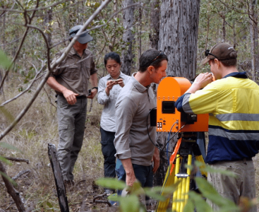
Using Australia’s most advanced laser scanner to measure the health of our forests as never before In the peaceful surrounds of the Karawatha forest in ...
Find out more
National Soil and Landscape Grid launched!
November 1, 2014
Uncategorized
26 November 2014 Knowledge of Australia’s diverse soil and landscape attributes is vital to enable informed use and management of our soils and landscapes. As ...
Find out more
Subscribe to TERN News
Project updates, data releases, research findings, and users stories direct to your inbox.


