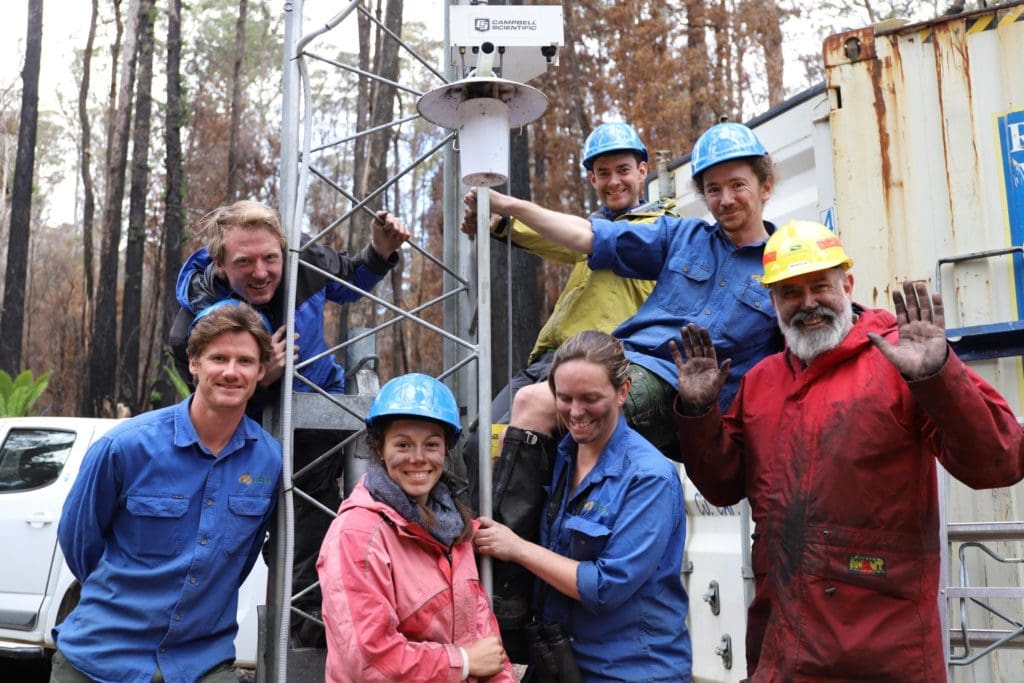
How can environmental research infrastructure providers, including TERN and its field-based NCRIS siblings, limit the damage extreme events have on sensors and other globally important environmental monitoring systems designed to deliver long-term, gap-free research and management data? A group of Australian and international experts reflect on this question and discuss the future direction of data collection technologies that may help alleviate some of the problems extreme events present.
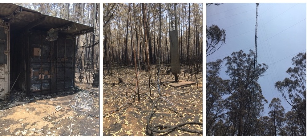
Over the past months, the world has been watching the multiple bushfire fronts in many parts of Australia with great dismay and sadness. Some of the affected areas and communities are home to TERN sites and staff are now starting to assess the consequences for their sensitive monitoring equipment and research projects.
But fire is just one form of extreme event that impacts the operation of land, coastal and ocean-based research infrastructure in Australia. Cyclones and floods cause havoc while extreme heat and long-term drought provide additional challenges for the kit and the dedicated people maintaining it.
NCRIS-enabled TERN is mandated to collect data on the ecological impacts of extreme events and our network of monitoring sites located in a breadth of ecosystems make that possible. The data collected from across the continent are essential for improving our understanding of the role that extreme events play in driving environmental change and also help to develop appropriate ecosystem policy and management strategies.
With this in mind, and faced with predicted increases in the frequency and severity of extreme events under a changing climate, TERN asked a group of Australian and international experts how Australian research infrastructure providers, including TERN and its NCRIS siblings, might best safeguard their globally important equipment and reduce gaps in their data streams? And, what is the future direction of data collection technologies that may help alleviate some of the challenges posed by extreme events?
Fire
Dr George Burba is a bio-atmospheric scientist with LI-COR Biosciences, the Robert B. Daugherty Water for Food Global Institute, and the University of Nebraska-Lincoln, and a global expert on in-situ micrometeorology, ecosystem gas and energy exchange measurement methods.
“Unfortunately, there is no fail-safe way to completely avoid data gaps during the time when fire is close by and upwind.
“However, there are definitely ways to minimise the gaps. For example, clear the area around the tower from debris, carefully back-burn the area several meters away from instrumentation, wrap or cover the cabling and soil-level instrumentation in heat-insulating materials and put cans or buckets over exposed devices. Remove most sensitive, expensive and flammable equipment, and turn off the power. These steps should allow quick re-installation and reactivation of the equipment after fire, minimising the data gaps.
“Real-time data collection and processing systems, on-site and remote location data storage will allow data to be collected right up until the last moment and to be resumed very quickly.”
Dr George Burba, University of Nebraska-Lincoln
Such tactics are standard practice in TERN and we have also where feasible, buried wiring to our automated sensors to limit damage to TERN’s ecosystem observatory.
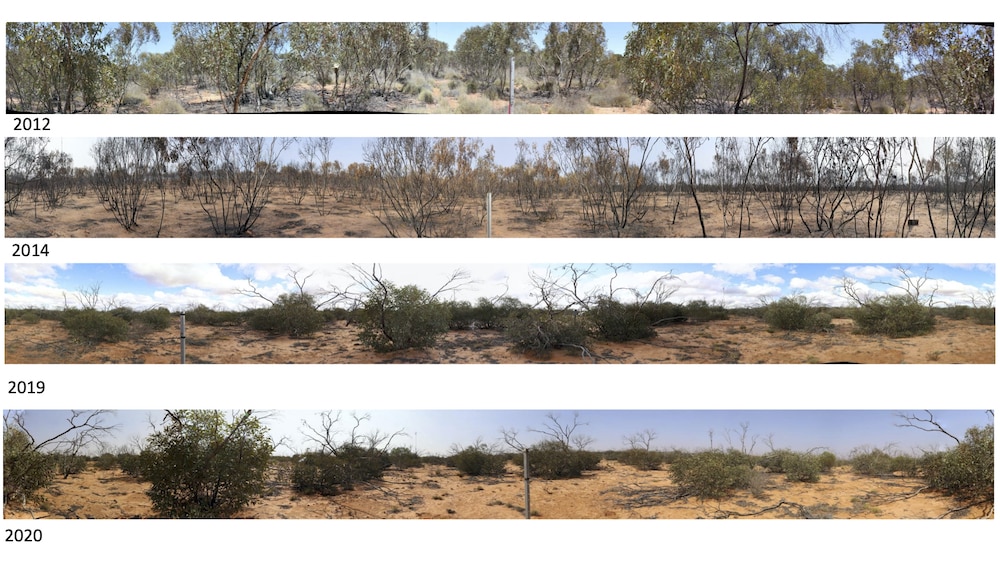
Perhaps the best example of a fire-resistant research infrastructure site is the fire-prone TERN Litchfield Savanna SuperSite in the Northern Territory. Almost every year, low-intensity fires pass right through the SuperSite, singeing on-ground monitoring equipment and getting caught on camera by automated camera-traps.
Like the ecosystem, TERN too has adapted over time and manages the site’s instruments to keep damage to a minimum.
Cyclones
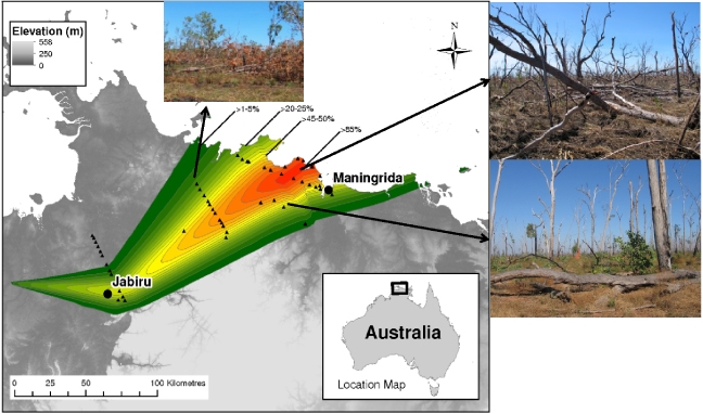
The Litchfield site, along with all of TERN’s research SuperSites across the Northern Territory and much of Queensland, are not only adapted to survive fire, but also cyclones. As a result, TERN is able to provide valuable data before, during and after multiple cyclone impacts, allowing scientists to study ecosystem recovery and better understand the underlying ecosystem processes.
TERN’s NCRIS sibling, the Integrated Marine Observing System (IMOS) has also worked hard to protect its ocean monitoring research infrastructure from the impacts of extreme conditions, including cyclones. IMOS Director, Dr Michelle Heupel says their equipment is specifically designed to produce high-quality data in harsh environments.
“Through robust designs and testing before deployment, we work to ensure our equipment can withstand extreme events as best possible, including employing engineering solutions to increase equipment retention.”
Dr Michelle Heupel, IMOS
Heatwaves
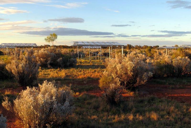
The vast majority of TERN instrumentation is research-grade and protected from dust, water and heat (and cold). Most instruments are rated from about -20℃ up to +70℃ and they tend to be white to maximise the reflection of heat, says Dr Craig McFarlane of CSIRO, TERN’s operating partner in the Great Western Woodlands SuperSite in Western Australia.
“Extreme heat shouldn’t be a problem unless you mean ‘bushfire heat’, which is difficult to defend against, especially for sensors that require free air movement around them or uninterrupted views of the sky or ground.
“Collecting data in remote and challenging locations, including those prone to extreme heat, requires the use of quality, research-grade instruments. Inferior quality kit will have more chance of failure.”
Dr Craig McFarlane, CSIRO
Data collection future directions
Given that extreme events are important drivers of Australian ecosystems and long-term monitoring of this change is in the national interest, what is the future direction of data collection methods and what role can technology play to help alleviate some of the problems extreme events present?
Dr Burba presents his view of a future environmental exchanges-monitoring research infrastructure operation (flux data):
“Everything is automated. No experts are needed at the site and processing is done on-site and in real-time with back-up on the cloud in real-time. Web-based remote access to the site is available 24-hours via cell phone and multiple sites are connected into one time-synchronized network.
“Everything at each site and between the sites is synched down to microseconds using GPS-driven PTP time protocol, the entire flux network is managed as one single research tool, both scientifically and operationally, for example, enabling the network to send status messages and alerts for specific towers to specific people based on user-defined criteria.
“In-situ data are processed, quality controlled, gap-filled, partitioned and allocated to a specific footprint on-the-go, and provided to remote sensing and modelling communities in near-real-time for ecological and hydrological scaling, modelling and forecasting.
“Basically, flux station networks will become as simple and automated as standard automated weather station networks, also becoming a valuable daily asset to other sciences and society in general.”
Dr George Burba, University of Nebraska-Lincoln
These predictions are already a reality in many places, but it’s important to emphasise the essential role people play, and will continue to play, in delivering such automated RI and their data.
Role of remote sensing
The role of remote sensing in extreme event data collection is ever-increasing as it allows timely and repeat data capture without the risk to personnel or on-ground instrumentation.
Many experts, including Dr Cindy Ong of CSIRO’s Earth Observation calibration and validation facility and chair of the Committee on Earth Observation Satellites (CEOS) Working Group on Calibration and Validation (WGCV), recognise this vital role but stress the on-going need for on-ground data for ensuring the integrity of Earth observation data and derived data products.
“Similar to on-ground instrumentation which requires routine calibration and validation, routine monitoring of remote sensing technologies and ongoing validation of the derived data products are essential.
“Australia’s extensive, long-term, well maintained and accessible network of on-ground network of calibration and validation instrumentation, including TERN’s, are highly valued by our international colleagues because of this need.”
Dr Cindy Ong, CSIRO
Both TERN and its NCRIS sibling IMOS, utilise both in-situ and remote sensing technologies. Dr Michelle Heupel says that IMOS has established a “New Technology Proving” facility which aims to improve observational efficiencies and effectiveness. This could potentially include testing of new technologies which help mitigate some of the extreme conditions IMOS infrastructure may face.
Real-time modelling and prediction
The next step for environmental research infrastructure, says Dr Burba, is to link all data collection activities together and directly feed the information into real-time modelling and predictions.
“Similar to how automated weather stations feed into weather and climate modelling and timely forecasting, in-situ environmental research infrastructure should be networked together with remote sensing data and fit into real-time ecological, agricultural and other modelling and forecasting. In my view, this is the future of environmental research infrastructure.”
Dr George Burba, University of Nebraska-Lincoln
Thankfully, due to NCRIS investment in the scoping of a National Environmental Prediction System (NEPS) for Australia, Dr Burba’s vision may be more than a pipe dream in Australia. If a future NEPS capability is funded, it will provide a federated national research infrastructure that enables the integration of environmental observations with predictive modelling and would provide the necessary processing and distribution system for trans-disciplinary data after it is collected and made model-ready by research infrastructure projects such as TERN and other agencies.
A NEPS would enhance the impact and uptake of research data and information products and services by decision-makers managing the environment, economy and the well-being of Australians.
Extreme event research
As work continues in scoping an environmental prediction capability, TERN is focused on providing continuity of data collection at all its sites, including those already impacted by the recent fires, to facilitate research into areas such as rate and extent of regeneration to deliver insights into spatial and temporal changes to biodiversity and carbon budgets in a changing environment.
In addition to on-going data collection from its network of surveillance plots and more particularly, at burnt TERN SuperSites in New South Wales and Tasmania, in 2020 TERN will prioritise detailed vegetation and soil surveys in Western Australia and South Australia to track ecosystem recovery at a number of sites along burnt and unburnt environmental gradients.
We’re examining ways in which this can happen while also gathering additional information on WA climate transition zones – it will be a busy year and to a large extent, it will be shaped by the changing priorities of researchers and as they become more focused on impacts from extreme events.
Similarly, the ARC LIEF-funded Australian Mountain Research Facility (AMRF) is reassessing its data collection and research plans, faced with the unique opportunities presented by operating equipment in regions impacted by fire.
Zach Brown of the Australian National University is the AMRF’s Senior Technical Officer and says that fires at planned sites across alpine New South Wales and Victoria have led to a rethink of their research.
“We planned to measure the impact of climate change on the ecology and hydrology of the Australian Alps. We had always intended to use AMRF to answer questions related to fire fuel loads but fire ecology was not the focus of the project. However, out of necessity and opportunity, we may now adjust our experimental design to include research questions related to fire ecology and the impact of fires on alpine ecosystems.”
Alpine ecosystems will undoubtedly change in response to shifting climate and fire regimes, but I’m confident that some alpine species will adapt to those conditions and other species not currently found in those ecosystems will expand their range. It is then a question of what these systems will look like in the future.”
Zach Brown, Australian National University
With tips and techniques for safeguarding Australia’s research infrastructure in hand and confidence that Australia’s brightest minds are hard at work using the collected data to improve our understanding of how extreme events drive environmental change, TERN, like Zach Brown, remains optimistic about the future of Australia’s precious ecosystems.
