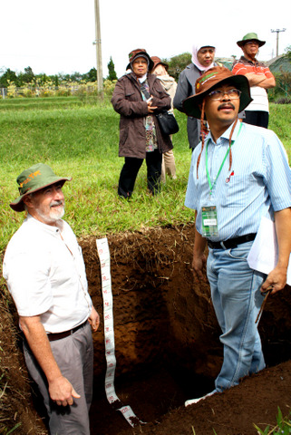
Mike Grundy (CSIRO) and Markus Andas (Indonesian Centre for Agricultural Land Research and Development) discuss the attributes of the fertile soils of Cianjur region of West Java (Photo courtesy of Claire Harris, CSIRO).
Through the work of TERN’s Soil and Landscape Grid of Australia, Australia is fast becoming a regional role model and a major player in international cooperative soil information.
The team working under TERN’s Soil and Landscape Grid of Australia will produce the world’s first complete version of the Digital Soil Map of the world called for by world-leading soil scientists in Science in 2009: ‘a fine-resolution, three-dimensional grid of the functional properties of soils relevant to users‘.
The grid is designed to underpin a wide range of ecosystem science and landscape management decisions.
This three-dimensional grid – representing information on soil function covering the continent and extending metres below its surface – provides a template for the production of key soil information infrastructure across multiple custodians, diverse data sets and data systems and complex needs. With this infrastructure and capability in hand, Australia is having a widespread international influence through the development and refinement of the methods and processes needed to build and share the grid.
More locally, the Soil and Landscape Grid of Australia team has recently been partnering on soil infrastructure projects with a number of nations in our near region, including Indonesia, New Zealand and a number of Pacific nations.
In one such international collaborative project, TERN’s Soil and Landscape Grid of Australia has been working with staff at the Indonesia’s Center for Agricultural Land Resources Research and Development (ICALRRD). The collaboration has been built around sharing of knowledge and skills in the production of the new soil functional grids, information modelling, communication activities and common approaches to building regional soil information capacities. A notable feature has been the extensive training program within Indonesia and Australia – through TERN’s partners at the University of Sydney.
‘This partnership is a great opportunity for our facility to share its knowledge and expertise and help some of our closest neighbours address their own complex land management challenges’, says Mike Grundy, the Facility Director of TERN’s Soil and Landscape Grid of Australia.
The project’s timing is apt and echoes our Chief Scientist’s recent calls for Australian science activities to be collaborative and strategic at an international level.
There has been breadth of collaboration and knowledge sharing undertaken by the Soil and Landscape Grid of Australia since its inception. Such collaboration was in evidence at the first GlobalSoilMap conference in Orleans, France last month.
GlobalSoilMap is the global equivalent of what the Soil and Landscape Grid of Australia is building in Australia – and Australian science and the TERN experience has influenced the development of the global specifications and its implementation.
Collaborators in the Soil and Landscape Grid, from all states and territories and a variety of organisations and institutions, such as Geoscience Australia, University of Sydney and CSIRO, met in Orleans, France to demonstrate to the global soil information community the progress that has been made in Australia.
A number of papers directly arising from the Soil and Landscape Grid of Australia were presented at the conference generating much interest in the project. It seems that the work already underway in Australia may provide a form of template as other countries and regions build the grid.
The global reach and influence of TERN, and Australia’s science community as a whole, is not only creating important scientific networks but is also strengthening Australia’s international relations. By sharing our scientific knowledge and techniques, in this case soil information infrastructure, TERN is helping to address the environmental management challenges we face, both in Australia and globally.
A full list of the GlobalSoilMap Conference 2013 abstracts can be downloaded here and a list of abstracts directly resulting from the Soil and Landscape Grid of Australia here.

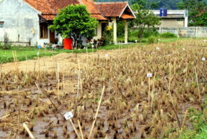
Rice and soil nutrition trials near Situ Gede, Indonesia (Photo courtesy Claire Harris, CSIRO)
Published in TERN newsletter December 2013


